Identity area
Reference code
JCCA/JCAD/3/CAM/JESL/38/2/1848
Title
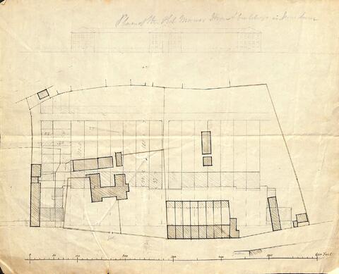
Plan of the site of Radegund Manor
Date(s)
- c. 1848 (Creation)
Level of description
Item
Extent and medium
1 item, paper
Context area
Archival history
Immediate source of acquisition or transfer
Content and structure area
Scope and content
Plan of the site of the old Manor House and eight houses (known as The Barracks), with sketch plan and elevation of terrace of houses proposed to be built on the site and Manor Street by James Webster.
Appraisal, destruction and scheduling
Accruals
System of arrangement
Conditions of access and use area
Conditions governing access
Conditions governing reproduction
Language of material
Script of material
Language and script notes
Physical characteristics and technical requirements
Finding aids
Allied materials area
Existence and location of originals
Existence and location of copies
Related units of description
Notes area
Note
Originally in box: "Cambridge All Saints Parish 5. Jesus Lane South Side 1, 1812-1901".
In a folder entitled "Jesus Lane S. Side. Plan of the Old Manor House & 8 Houses & of Proposed Rebuilding. Webster".
